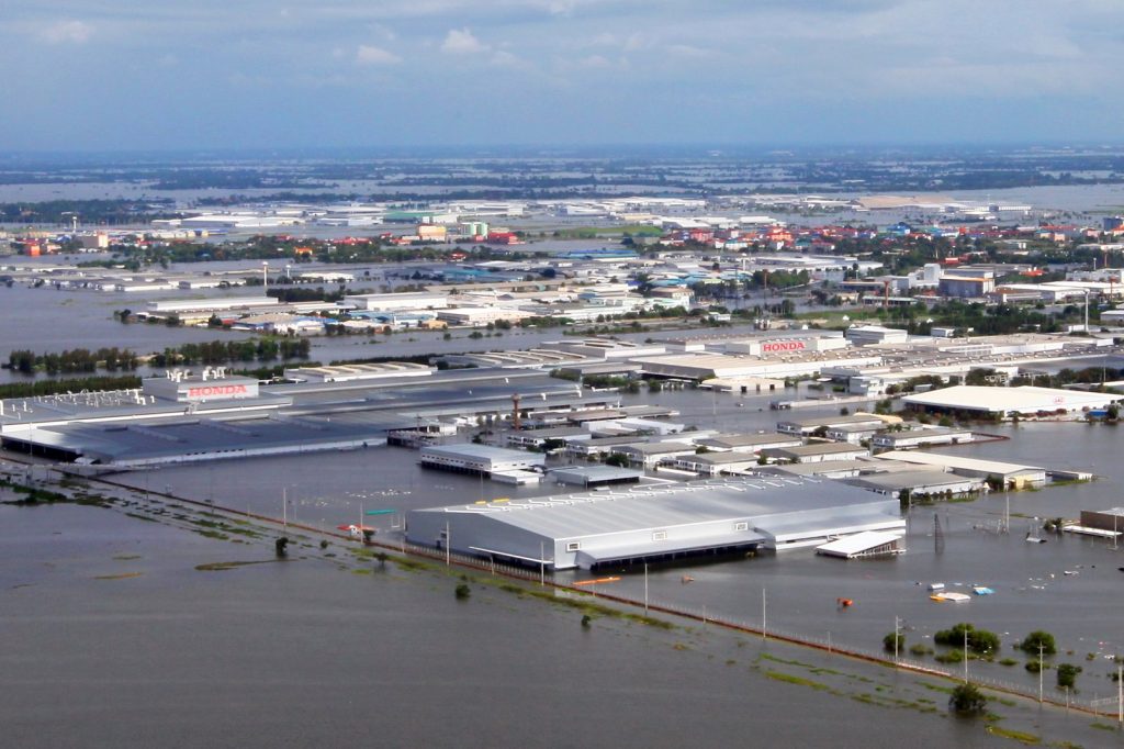
Seven industrial estates sat under as much as three meters of water. That single fact explains why the 2011 floods in Thailand reached far beyond Thailand: the factories there made car parts and hard disk drives, and the world felt it for the whole of 2012.
The World Bank put the economic losses at 1.425 trillion baht, or US$46.5 billion, as of 1 December 2011. Most of it came from manufacturing. That made the flood the fourth costliest disaster anywhere at the time, behind only the Tohoku earthquake and tsunami, the 1995 Great Hanshin earthquake and Hurricane Katrina. The death toll stood at 815, with three people missing, and 13.6 million were affected.
From a storm in July to the capital in October
It began at the end of July, when Tropical Storm Nock-ten came ashore in northern Vietnam and dumped rain over northern and northeastern Thailand. Flash floods hit many provinces from 31 July. A multi-year La Niña kept the rain coming longer than usual. By late August the death toll had reached 37, and by 19 September almost every lower central province was affected.
Early October brought the worst of it. Most dams were near or over capacity and had to release more water, which risked worsening flooding downstream. Water entered the city of Ayutthaya, flooded the Ayutthaya Historical Park and forced evacuations. Barriers around industrial estates failed, and dozens of major factories went under. In Nakhon Sawan the sandbag wall gave way and the city flooded fast. Hundreds of patients were taken out of two regional hospitals by boat after water rose over the floors and cut power and life support.
Sixty-five of Thailand’s 76 provinces were declared disaster zones, and over 20,000 square kilometres of farmland was damaged. Some areas stayed flooded until mid-January 2012.
The fight to keep Bangkok dry
By mid-October the capital was under serious threat. In Pathum Thani, just north of Bangkok, crews kept reinforcing sandbag walls to stop the Chao Phraya and Rangsit canals from spilling over. Water diverted toward the Nakhon Nayok River and outlying canals flooded districts in eastern Bangkok outside the city’s flood wall. When barriers in Pathum Thani failed, more industrial estates and suburban neighborhoods went under.
On 20 October a barrier protecting the Khlong Prapa water supply canal was disrupted, and floodwater ran down to Sam Sen in central Bangkok. The breach was brought under control, but residents panicked and parked cars illegally on flyovers and parts of the elevated expressway. Thammasat University’s Rangsit campus, the largest evacuation center, took two meters of water, and its final exams were postponed three times.
A 2015 study suggested that floods of similar intensity are becoming more likely. Bangkok and the nearby provinces sit only 50 centimeters to two meters above sea level.